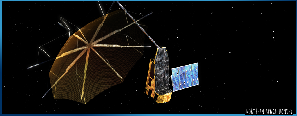


Biomass, the ESA mission to deliver crucial information about the state of our forests and how they are changing, successfully launched from Kourou in French Guiana on the 29th April aboard a Vega-C rocket.
An unusual-looking umbrella-like antenna of 12m in diameter sits atop the 1250kg satellite which operates the first P-band radar in space.
The P-band synthetic aperture radar can penetrate through the forest canopy to measure the 'biomass' (woody trunks, branches and stems) where trees store most of their carbon, helping scientists quantify the stored carbon in our forests. This will further reduce major uncertainties in calculations of carbon stocks and fluxes on land, including carbon fluxes associated with land-use change, forest degredation and forest regrowth.
Optical sensors can only offer a picture of the forest extent from the top of the canopy, with cloud cover further limiting data collection, however the Biomass satellite's P-band synthetic aperture not only 'sees' through cloud cover, it slices through the whole forest layer. The signal scattered back to the satellite carries information about the forest structure that can be used to infer parameters such as forest biomass and forest height.
The innovative mission also offers the opportunity to map subsurface geology in deserts, map the ice structure of ice sheets and map the topography of forest floors.
ESA's Biomass satellite was designed and built by a consortium of more than 50 companies under Airbus UK as the prime contractor.
Keywords: Space ESA Satellite Biomass P-band Forest Radar Vega-C